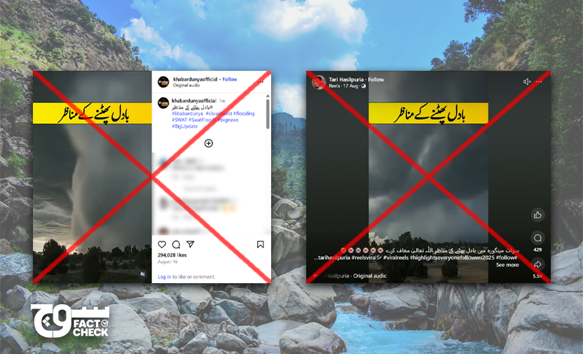
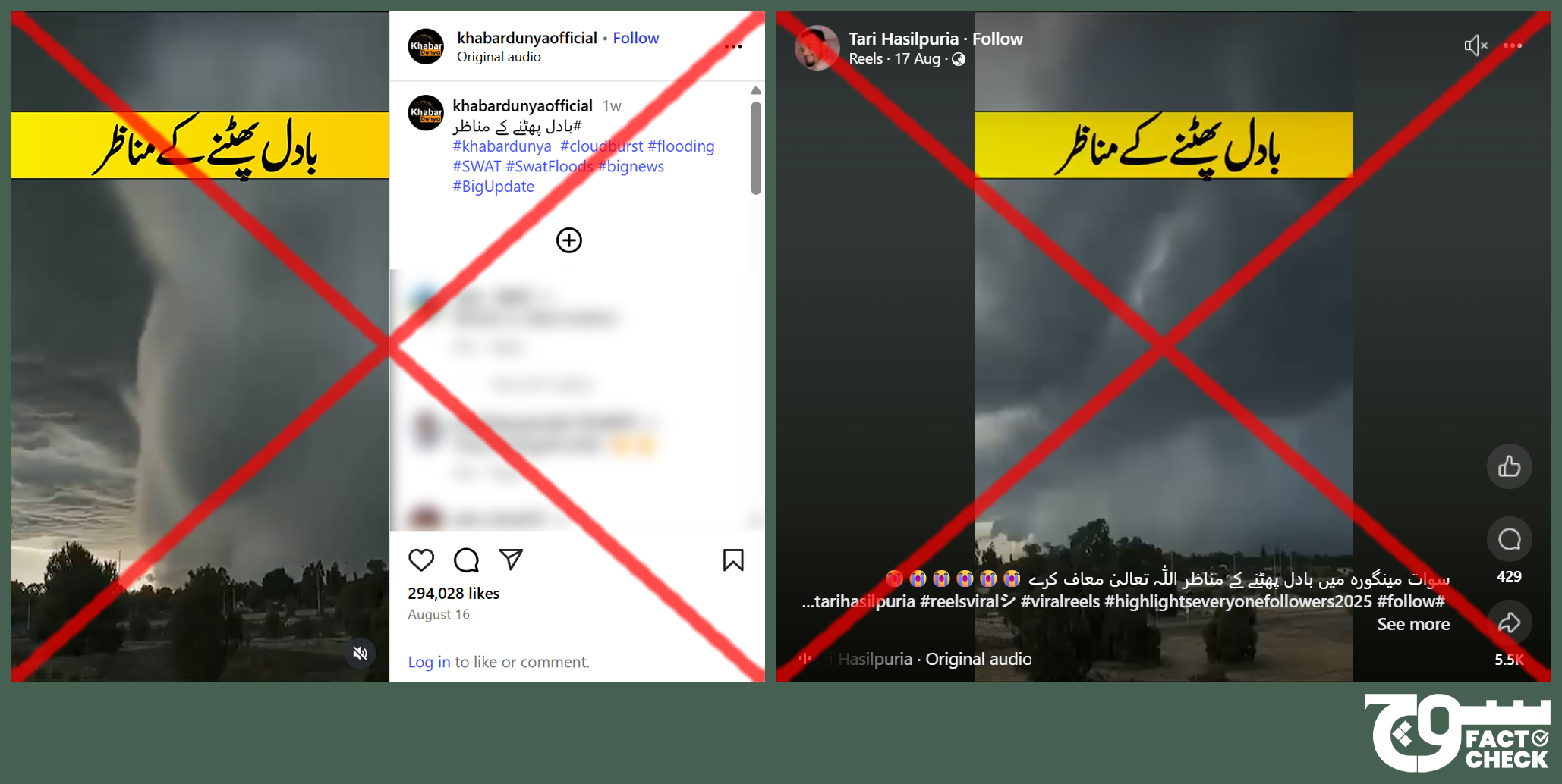
Claim: A video shows a sudden downpour as part of a cloudburst in Mingora, Swat.
Fact: The viral video is, in fact, from 2020 and likely shows a wet microburst in Perth, Australia.
On 16 and 17 August 2025, multiple social media users shared a video claiming that it showed a cloudburst in Mingora, Swat in Pakistan’s Khyber Pakhtunkhwa (KP) province (archived here, here, and here).
Hundreds killed in flash floods
The death toll from flash floods in Pakistan has risen to over almost 800, according to media reports, which cited the Provincial Disaster Management Authority (PDMA); more than 400 fatalities of these were in KP.
At least 5,574 livestock also perished, according to data (archive) compiled by the National Disaster Management Authority (NDMA), as of 25 August.
ReliefWeb, an information portal by the United Nations (UN) Office for the Coordination of Humanitarian Affairs (OCHA), said on 26 August that Buner — a district in KP — was hit hardest with the highest number of people killed at 228.
Upwards of 1,000 people have been injured since 6 June and 7,225 houses destroyed, as of 17 August 2025. “The affected districts include Swat, Buner, Bajaur, Torghar, Mansehra, Shangla, and Battagram,” the KP government said.
At least 89 trucks worth of aid was delivered to affected districts on the orders of KP Chief Minister Ali Amin Gandapur, it said, and the PDMA has released PKR 800 million to the affected districts and PKR 500 million to Buner. PKR 1 billion was also provided to the Rescue and Relief Department to support flood affectees.
A meeting about the flood situation, held on 17 August 2025 at the Malakand Commissioner’s office and chaired by Gandapur, was briefed that the city of Mingora was most severely affected.
Rescue officials and district administration have appealed to people to relocate to safer areas as Swat became victim to flooding yet again on 18 August, Express News’ Urdu website reported.
In an update on 15 August, the KP government said, “On the directives of the Khyber Pakhtunkhwa health advisor, a health emergency has been imposed in the flood- and rain-affected districts (Buner, Swat, Mansehra, Bajaur, Mohmand, Abbottabad), flood control rooms established, all medical staff put on high alert, leaves canceled, and treatment [of patients] in hospitals continues uninterrupted.”
“Rescue officials evacuated 2,071 individuals to safe locations,” it added.
“The provincial rescue agency told AFP that about 2,000 rescue workers were engaged in recovering bodies from the debris and carrying out relief operations in nine affected districts,” The Guardian reported.
Many of the residents were caught off guard, with one telling Al Jazeera that the floodwater “came so fast that many could not leave their homes”.
“Climate change has directly amplified the triggers of cloudbursts in Pakistan, especially. Every 1°C rise allows the air to hold about 7% more moisture, increasing the potential for heavy rainfall in short bursts,” ABC News said, quoting experts.
The situation is made worse because of the unexpectedness of this phenomenon, with Pakistani officials saying “a warning to allow evacuations was not possible, as the cloudburst struck before residents could be alerted”, ITV reported.
In a 16 August weather alert, the Pakistan Meteorological Department (PMD) warned of torrential rains that “may generate flash floods in local nullahs/streams of Chitral, Dir, Swat, Shangla, Mansehra, Kohistan, Abbottabad, Buner, Charsadda, Nowshera, Swabi, Mardan, Murree, Galliyat, Islamabad/Rawalpindi, Northeast Punjab, and Kashmir from 17 th to 19st (sic) August”.
It warned that there were chances of landslides and mudslides, which could impact commuting, while heavy rainfalls, windstorms, and lightning “may damage weak structures like roof, wall of Kacha houses, electric poles, bill boards, vehicles and solar panels etc during the forecast period”.
Fact or Fiction?
Reverse-searching keyframes from the viral video led us to multiple instances when the clip was posted prior to 2025, confirming that it is old and unrelated to the flooding and severe rainy weather in Swat.
The 27 February 2020 video by YouTube channel AU Online is titled “Micro explosão – fenômeno climático – Área de instabilidade [Micro explosion – climatic phenomenon – Area of instability]” and includes watermarked text “Kane Artie Photography” in the top-right corner.
Kane Artie is a photographer based in Perth, a city in Australia, and they uploaded the video on Instagram and Facebook on 1 and 2 August 2022, respectively.
The caption of the Facebook post states that it was “Captured in 2020”.
When we scrolled further down the videos on Artie’s page, we found the original posted on Instagram and Facebook on 26 and 25 February 2020, respectively.
The Instagram caption is as follows:
“WOW 🤯 This absolutely blew my mind. This was a storm that rolled through Perth yesterday arvo [afternoon]. I made a last minute dash down to the Perth airport viewing area as it’s only 3 minutes down the road and I knew I would have a clear view up there. Nothing could have prepared me for what I witnessed. It was incredible to watch it slowly creep towards me. I didn’t have a clue what was actually happening. I have since found out that apparently this is a microburst. I didn’t have a clue that the timelapse was going to look like this 🤯 When I finally had to run back to the car I made it halfway down and it hit. It came with such force that the wind nearly blew me clean off my feet. I was clawing my was along a fence to stay up right and get back to the car. What a crazy experience. I am absolutely thrilled to have captured this. For licensing of this content please contact www.severeweather.com.au.”
The Facebook caption is as follows:
“Well this afternoons (sic) front that rolled in was something else! I made a last minute dash down the road to the viewing area at the Perth Airport as I knew I would have a nice open area to shoot. So glad I did. I got absolutely drenched running back down the ramp, and nearly got blown over with the gusts that came through. I had to hang on to the fence to stay on my feet. Was it worth it….. Hell yes 😁 Media licensing available via Severe Weather Australia.”
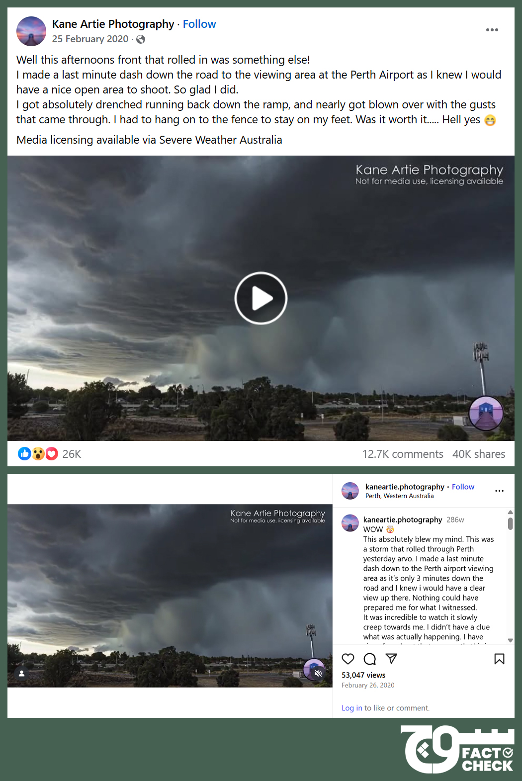
The Facebook page of Higgins Storm Chasing — a website about forecast, warnings, and observations by weather enthusiast Jeff Higgins — shared Artie’s video on 25 February 2020 as well, stating that it showed severe storms in Perth from that afternoon. The caption added that it was an “amazing capture of the wall of water cascading down from the clouds as the storms entered the City region”.
It further explained, “This is likely either a set of microbursts (numerous microbursts in close proximity to each other) or one large macroburst complex. The difference in it either being (sic) called a macroburst or microburst is based on the size of the downburst.”
Microbursts, macrobursts
Macrobursts and microbursts “are very intense downdrafts that occur within severe thunderstorms and supercell thunderstorms”, according to Higgins Storm Chasing. “These downdrafts surge from the clouds, down to the surface where the winds then hit the surface and spread out in a 360º fashion.”
Wet microbursts “are far more common closer to the Coast and where high levels of tropical moisture are present”, the website states, adding that they “are also accompanied by very heavy, potentially torrential, bursts of rainfall which will likely cause localised flash flooding”. It likened the visuals of this phenomenon to “a rain bomb dropping out of the sky”.
Tim’s Severe Weather, a platform for “accurate and timely severe weather forecasts and updates in Queensland and New South Wales”, also shared the same footage, writing that it was “by far the most vivid and spectacular Multiple Microburst Event (rain bomb) footage caught on camera”.
The US-based National Weather Service (NWS) says wet microbursts “are accompanied by significant precipitation”, while Encyclopaedia Britannica states they are “typical of more humid areas” and “generally accompanied by a visible rain shaft”.
The Australian government’s Bureau of Meteorology (BOM) posted footage of the same storm on 26 February 2025, depicting similar scenes, captured by the Perth Airport web cam. It said, “The intense storm brought damaging winds, heavy rainfall and hail, bringing down trees and causing damage to homes and buildings. The strongest wind gust was 126 km/h at Kalannie to the northeast of Perth, while Perth Metro recorded a gust of 80 km/h.”
The microburst was also captured in a picture from a different location by The Watchers, a website that focuses “on Earth, science, and space”.
On that day, state broadcaster Australian Broadcasting Corporation (ABC) reported, “Perth residents have been left bewildered this week as ferocious storms have appeared seemingly out of nowhere, causing widespread destruction in a matter of minutes.
“Many people were caught off guard by a particularly powerful and fast moving cell that barrelled in from the north on Tuesday, despite the risk of thunderstorms featuring on the forecast for Perth all week,” it added.
In another report, the ABC quoted BOM senior meteorologist Sally Cutter as saying that “an ‘unstable atmosphere’, a lot of moisture in the air and a trigger” are required for a microburst to occur.
Therefore, Soch Fact Check concludes that the footage has been wrongly linked to the recent floods in Swat and is actually old and from Australia.
Virality
Soch Fact Check found the claim posted here and here on Instagram, here, here, here, and here on Facebook, and here on TikTok.
Conclusion: The viral video is old and unrelated to the recent flooding and severe torrential rain in Swat. It depicts a wet microburst in Perth, Australia, in February 2020.
Background image in cover photo: asad
To appeal against our fact-check, please send an email to appeals@sochfactcheck.com