Additional reporting: Sidra Dar
Map visual: Fizza Qureshi
Video editor: Muhammad Abid
💡
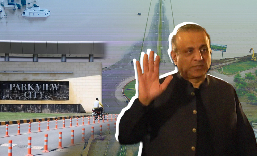
Claim: Shortly after heavy rainfall in August, federal minister and owner of Park View City Aleem Khan said water “did not breach” the residential society in Lahore at any point. Everything was “safe” and people were “not forced to relocate”, he added. Additionally, Park View City’s official post on Instagram said that “not a single drop of floodwater” had entered the area.
Fact: Aleem Khan’s claim is incorrect. Multiple large sections of the housing society were completely submerged, with floodwater entering homes and stagnating on the streets, forcing many to leave.
Hundreds killed in floods
Pakistan’s monsoon season began in June 2025, wreaking havoc in Khyber Pakhtunkhwa (KP), Punjab, and Sindh. This, coupled with the release of water from Indian dams, contributed to widespread flooding due to overflowing rivers, including Sutlej, Chenab, and Ravi.
Consequently, this water entered the Indus River triggering flood alerts in Sindh.
Swollen rivers and floodwater submerged the villages, agricultural land, and residential areas situated along the edge of the rivers in Punjab.
As of 1 October, the overall death toll from flash floods in Pakistan stood at 1037, according to data (archive) compiled by the National Disaster Management Authority (NDMA), which revealed that more than 500 of these fatalities were in KP.
Additionally, upwards of 1,000 people were injured, 229,763 houses damaged, and 22,841 livestock have perished from 26 June to 1 October, according to the NDMA.
The flooding did not spare Lahore’s Park View City either, which is located near river Ravi.
At a news conference in August, NDMA Chairperson Lt Gen Inam Haider Malik said weather in Pakistan was changing drastically due to climate change, Al Jazeera reported, quoting him as saying, “The intensity of this year’s monsoon is around 50 to 60 percent more than last year.”
“Climate change has directly amplified the triggers of cloudbursts in Pakistan, especially. Every 1°C rise allows the air to hold about 7% more moisture, increasing the potential for heavy rainfall in short bursts,” Arab News said, quoting experts.
The situation is made worse because of the unexpectedness of this phenomenon, with Pakistani officials saying “a warning to allow evacuations was not possible, as the cloudburst struck before residents could be alerted”, ITV reported.
💡
Aleem Khan’s claims
On 28 August 2025, Communications Minister Aleem Khan issued a statement rejecting claims that Park View City, the housing society in Lahore owned by him, was flooded during the recent monsoon rains that wreaked havoc in multiple cities across Pakistan.
In the video statement, he claimed that the housing society was safe from flooding because of the many bands — also known as floodwater barriers or mud embankments — that the management had created, while adding that not a single resident had to relocate.
Khan also said his team constructed floodwater barriers that “proved to be so strong that there was no breach of water at any single location”.
Park View City in Lahore is a commercial housing project by Vision Group, a real estate company run by Aleem Khan, located on the edge of the Ravi river.
💡
Our methodology
Soch Fact Check initiated this investigation as a lawmaker publicly claiming his housing society remained unaffected by flooding during a natural disaster warrants scrutiny given potential public safety implications.
To examine Khan’s claim, Soch Fact Check used open-source intelligence data and on-ground reporting by correspondents for Soch Videos, our sister organisation. We geolocated 10 clips from Park View City, examined publicly-available satellite imagery from the Copernicus Browser, which also provides environmental data, and analysed aerial footage of the housing society shot by our journalists.
These methods allowed us to pinpoint one of the exact locations where the floodwater from Ravi breached the protective barriers installed by the management to protect Khan’s housing society from flooding.
Clips posted online on social media — verified by our team — and drone footage by Soch Videos show various areas of society completely submerged in floodwater, risking the safety of its residents.
Furthermore, our satellite imagery analysis provides an aerial view of the residential areas that were flooded, thus, revealing how the water entered and damaged large portions of Park View City.
💡
Fact or Fiction?
Soch Fact Check investigation found Aleem Khan’s claims to be false.
On 28 August — the day Khan claimed via the society’s Instagram page that his housing society was completely safe — videos posted online showed floodwater from the Ravi breached protective walls in the Platinum Block, a residential area within Park View City situated on the edge of a riverbank.
Soch Fact Check geolocated two videos, posted online on 28 August, showing floodwater that breached the protective barriers — known as mud embankments, an ancient method that uses raised man-made soil structures along the river to control or prevent flooding — and entered the Platinum Block.
💡
Floodwater breaches Platinum Block
The first clip shows police standing in this area as well as part of the boundary wall of the residential area near the river bank that is broken. The camera then pans to show water rushing inside the boundary wall and breaching the protective barrier.
“This embankment is broken and the water is entering very fast,” says a man, capturing the moment.
Geolocating this clip reveals that it was recorded at the coordinates 31.463662099631453, 74.17430712545962 on the edge of the riverbank in the Platinum Block.
At the 0:11 mark, the camera pans to the right, showing two adjacent structures, likely houses in the residential area.
(Note: At the time of research, Google Earth Pro regressed its imagery to older versions, hence it was not possible to use Earth Pro for geolocations. So the researchers used alternative mapping services. However, at the time of publishing, Earth Pro has the latest imagery available and Soch’s findings can be checked against it.)
These houses are visible in satellite imagery of the exact location on Mapillary, a crowdsourced platform that offers street-level photos from around the world and uses Esri satellite imagery as a base map (at the time of publication, available on Google Earth Pro as well).
Comparing the clip with Mapillary confirmed that two houses from the video are at the 31.463662099631453, 74.17430712545962 coordinates on Google Maps.
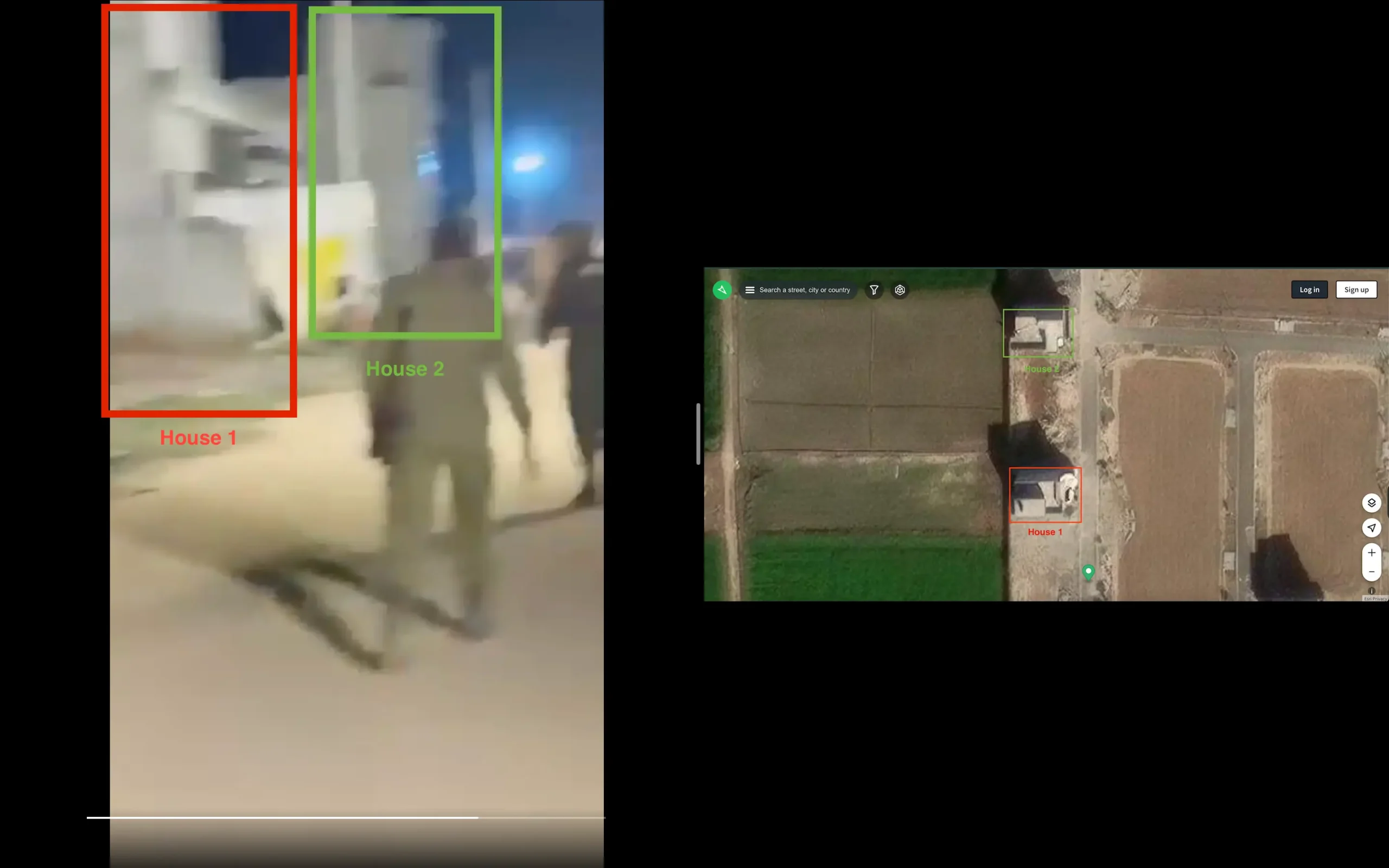
On the left are two houses from the video matched against the satellite imagery base map from Mapillary.
Notably, we were able to match the roof of the second house in the clip against the satellite imagery by Mapillary — as shown below — which indicated that the video was indeed shot at this location.

The roof of the second house matches the one shown in Mapillary.
The satellite layer by Apple Maps also shows the two houses in the exact location: the edge of the river in Platinum Block.
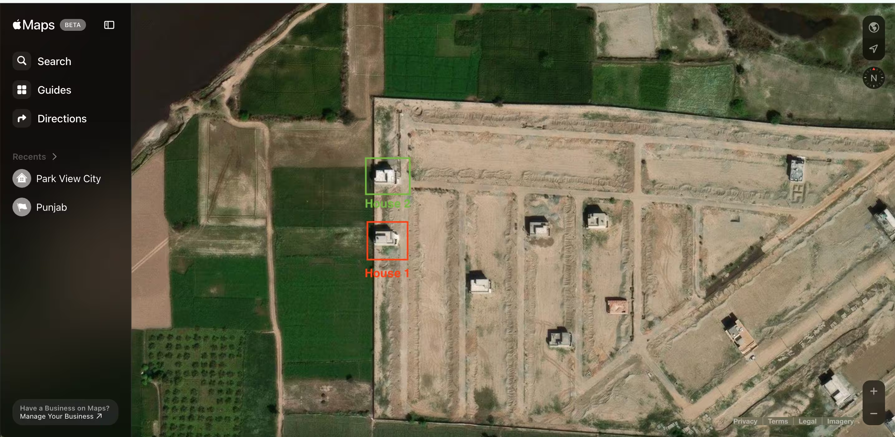
Satellite view from Apple Maps that shows the two houses at the exact coordinates as in Google Maps.
Further analysis of other features from the first clip confirms that it depicts the location where the floodwater breached the embankment. On the left, at the 0:02 mark, three poles are visible: one pole close to the camera and two others towards the extreme left of the frame, where a small red-roofed hut is also visible.
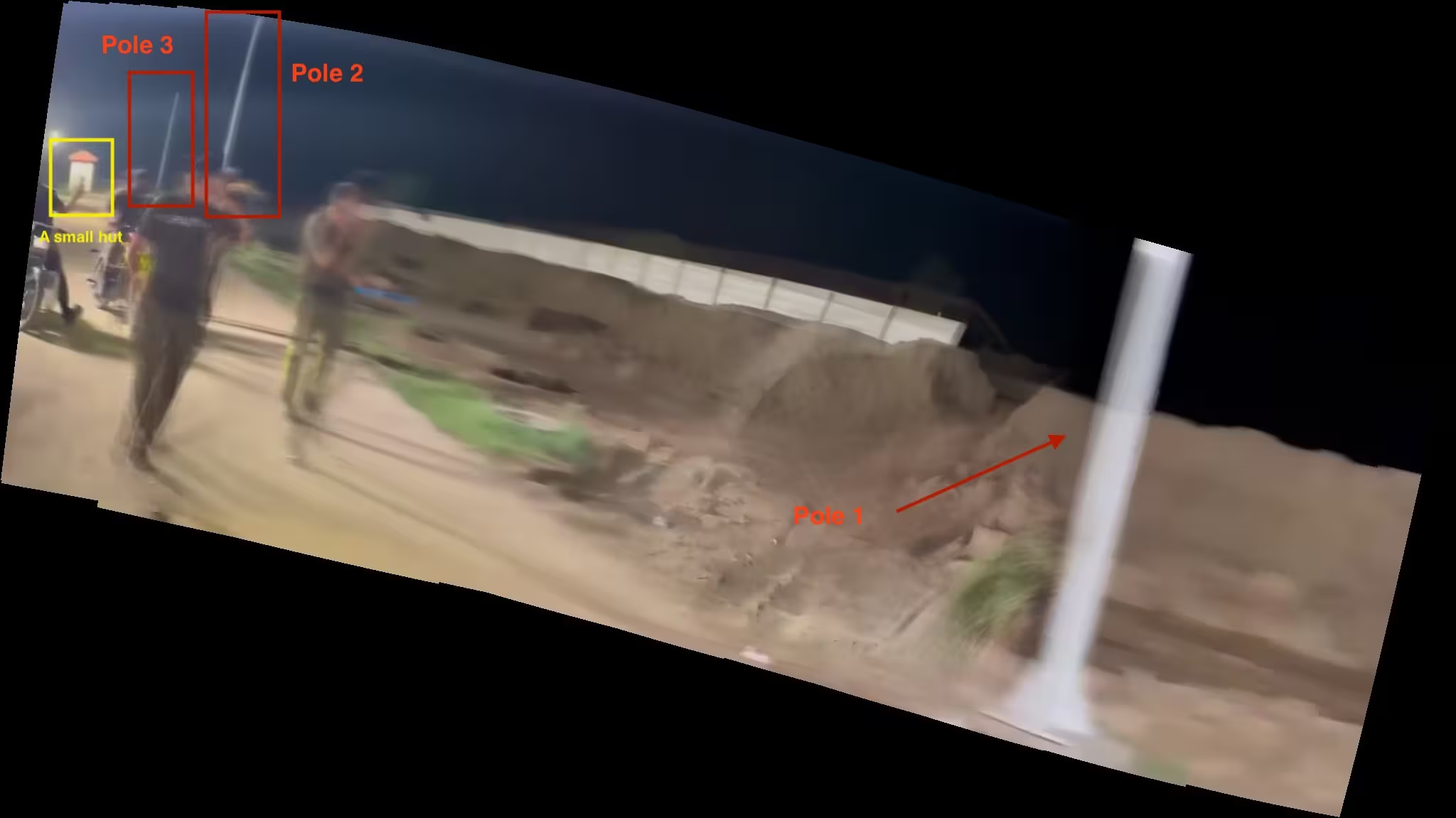
A panorama created from keyframes of the video shows an additional set of features. Tool used: Autostitch
To verify whether these features are indeed located near the river in Platinum Block, Soch Fact Check compared the first clip to additional drone footage of the area posted on YouTube on 5 September after the flooding. The three poles, the small hut, and the two houses visible in the geolocated clip also appear at the 0:05 mark of the YouTube video. This is highlighted below:
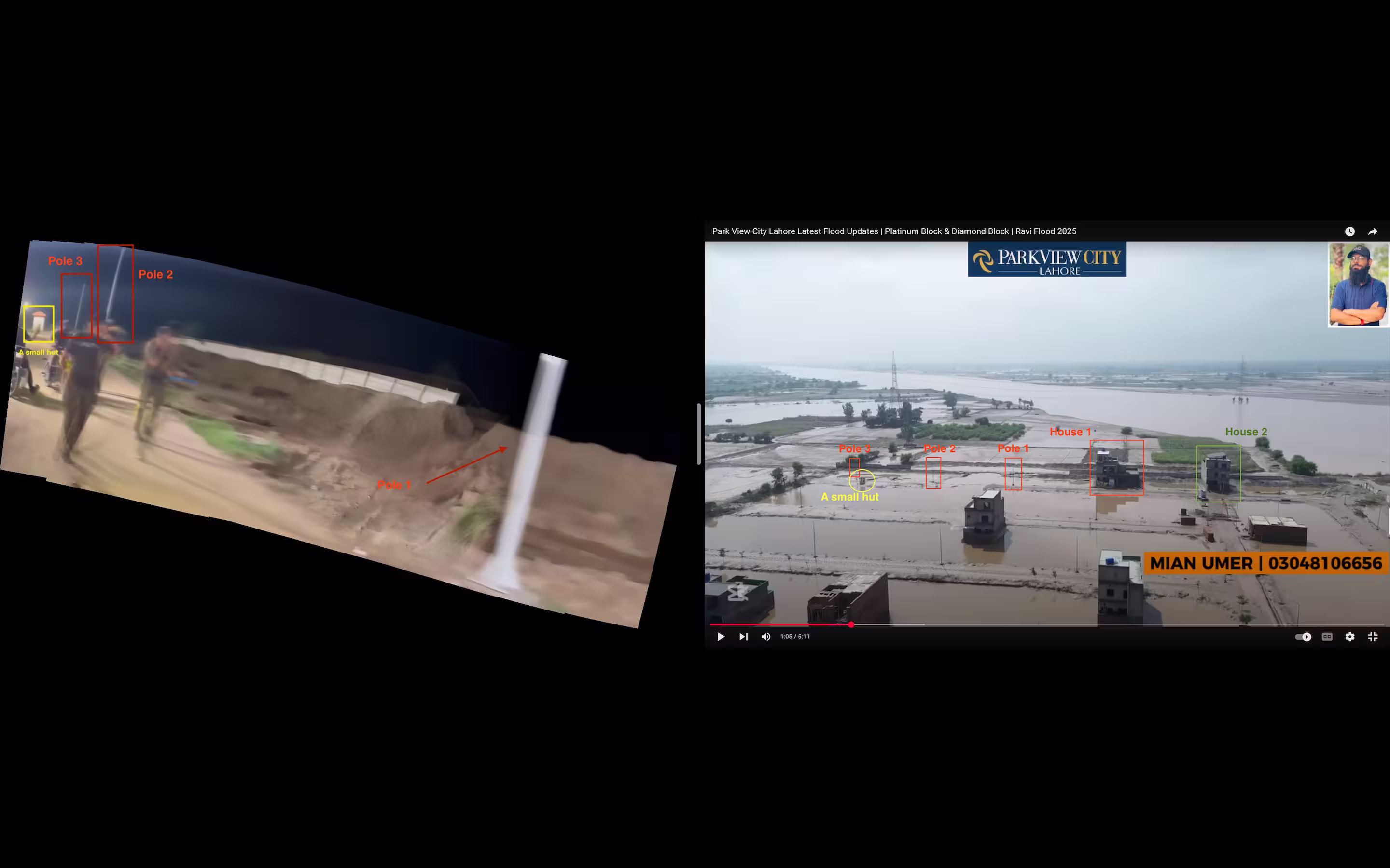
On the left is a panoramic view of the area, created with keyframes of the geolocated clip, and an aerial view of the same area, featured in drone footage in the YouTube video, is given on the right.
Further comparison of the same frame from the YouTube video with Apple satellite imagery confirms that this clip shows the exact location from the video shared on X, as shown below:
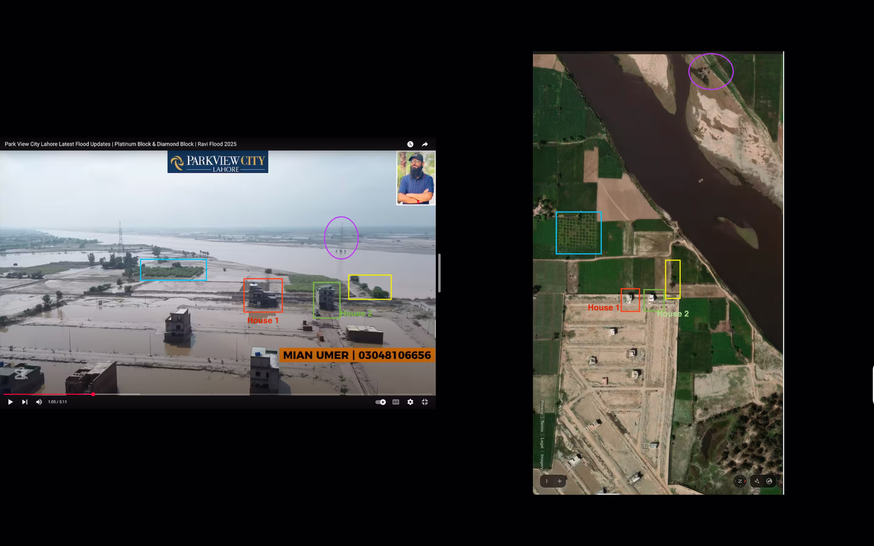
On the left is the keyframe from the YouTube clip showing the exact location, and on the right is the imagery from Apple Maps depicting the location of the video shared on X.
Our analysis above, therefore, confirms that the video circulating online shows floodwater breaching an embankment in the Platinum Block.
Regarding the broken boundary wall shown in the first verified video, Soch Videos correspondent Sidra Dar said, “Due to increasing floodwater in the Ravi river, the Park View City administration broke this wall around 28 August as videos emerged showing the police announcing immediate evacuation orders for the residents to leave their homes.
“Some journalists in Lahore said that the administration partially broke the wall owing to fears that the entire barrier could break if the water was not allowed to flow and cause more damage,” she added. “However, they [the administration] did not realise that the flow of water was so strong that it would end up affecting several blocks of society. This video is from the same night when many people left their homes.”
Therefore, Soch Fact Check’s thorough analysis of the first video confirms that, contrary to Aleem Khan’s claim, floodwater did breach the embankments built by the society’s management.
💡
Floodwater enters Platinum Block after breach
A second (archive) video of the Platinum Block, posted on 28 August on X (formerly Twitter), was geolocated to coordinates 31.464112309492883, 74.17555529502641. This clip shows floodwater having entered the Platinum Block after the embankments were breached (as shown in the first clip).
The house shown at the 0:08 mark matches the one shown in the satellite imagery of the area on Apple Maps.
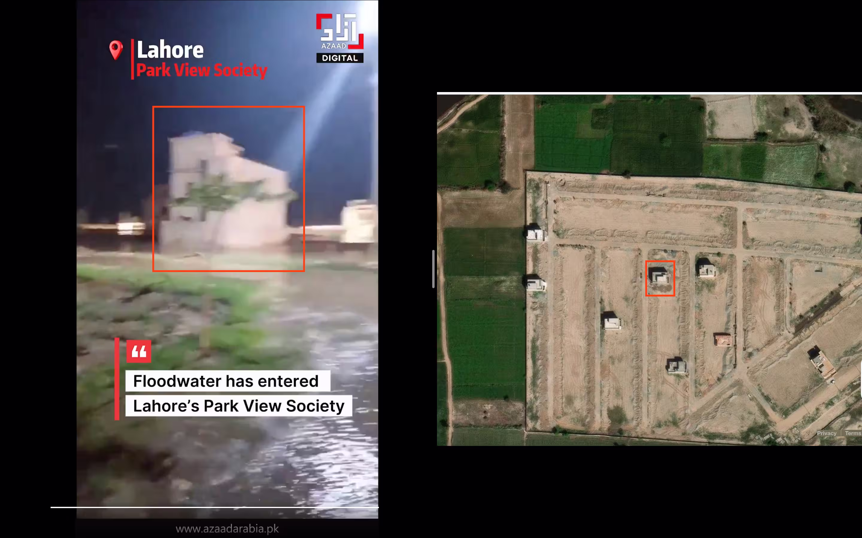
On the left is the house from the second video that matches the one shown in the satellite imagery from Apple Maps.
This video also shows the same two houses that Soch Fact Check verified in the first clip posted on X, confirming that it was also filmed in the Platinum Block but further away from the embankments.
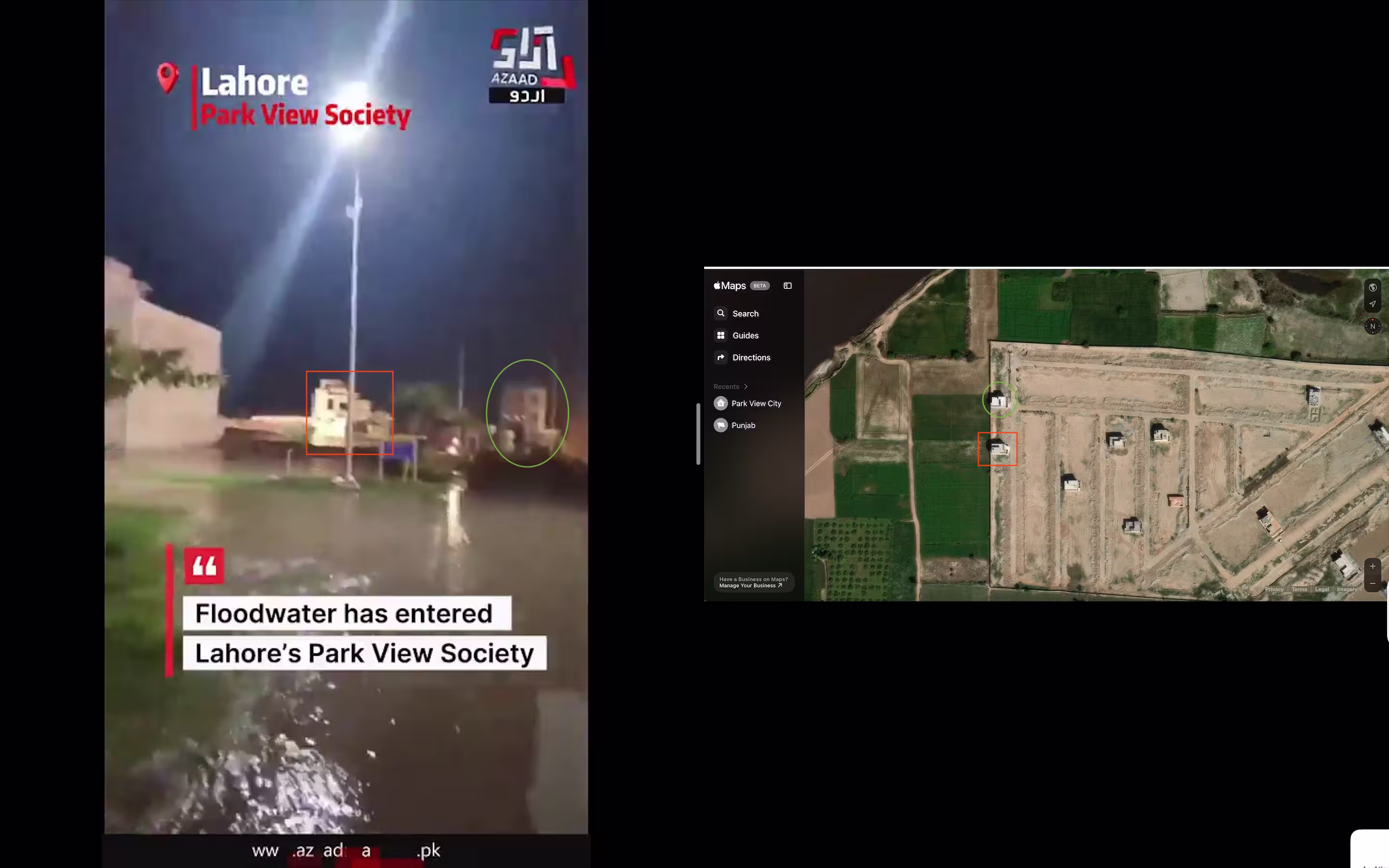
The two houses in the first clip also appear in the second one. On the left is the frame from the second video showing those structures that match the ones in the satellite imagery of the area, on the right.
💡
Flooding endangers Platinum Block residents’ safety
As the floodwater wreaked havoc across the residential area, rescue teams on boats, wearing life-saving jackets, navigated the flooded area to rescue stranded residents, according to the geolocated videos. Furthermore, these verified clips also show areas in the Platinum Block that were entirely or partially submerged.
One such video from 13th Street in the Platinum Block shows a rescue team saving a stranded child from the second floor of a house submerged in floodwater. The exact location in this video was found at the coordinates 31.461728279111195, 74.18235694197806.
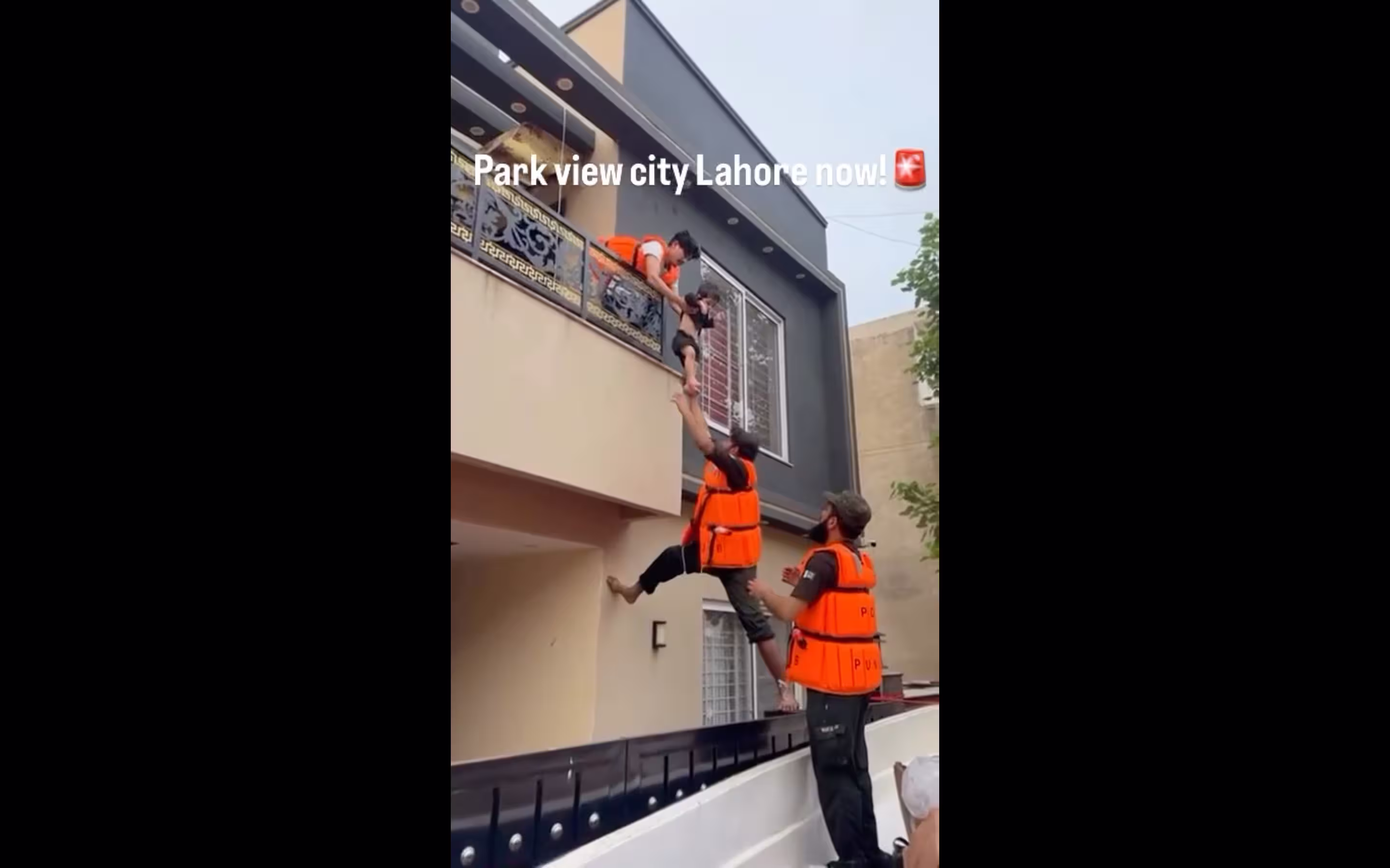
Geolocated video shows a rescue team saving a stranded child from a submerged house in the Platinum Block.
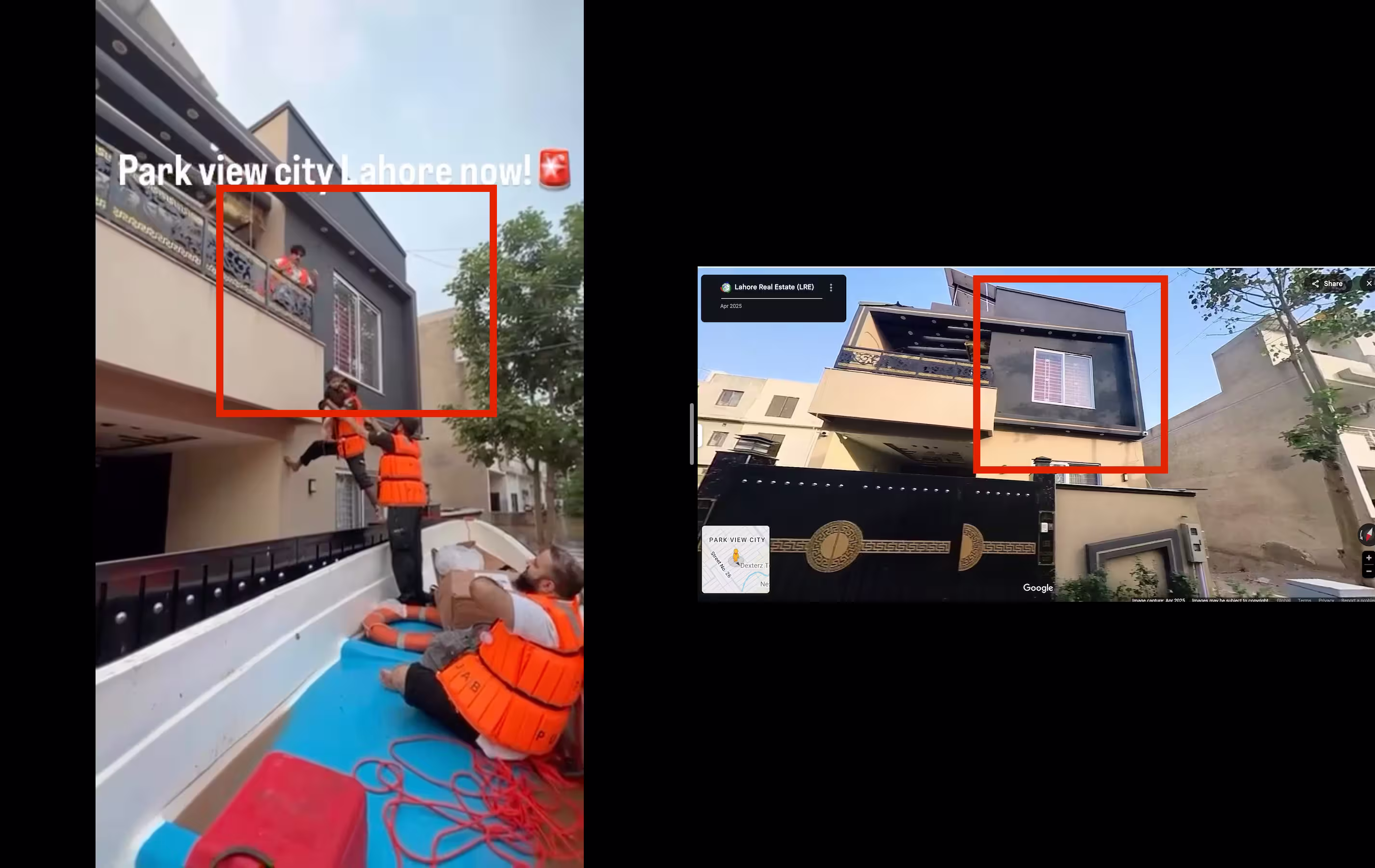
On the left is the screen grab from the verified video. On the right is the same house via the Google Street View imagery.
This clip of the stranded child being rescued debunks Khan’s claim that his housing society’s residents were safe during the floods.
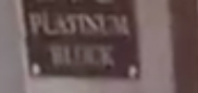
Another video, geolocated in the same residential block, shows houses — visible at the coordinates 31.45786686144117, 74.1806963695235 — completely submerged.
At the 0:22 mark, the rescue team’s boat passes a house where the plaque reads “Platinum Block”, indicating the video was recorded somewhere in this part of the residential area.
Then, at the 0:36 mark, the boat passes to show “211” painted on the wall of a house. This numbering represents the plot number assigned to each piece of land where houses can be constructed, as confirmed by the map of the residential block available on the real estate website Zameen.com.
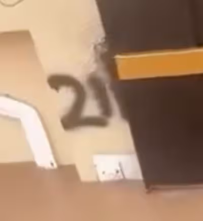
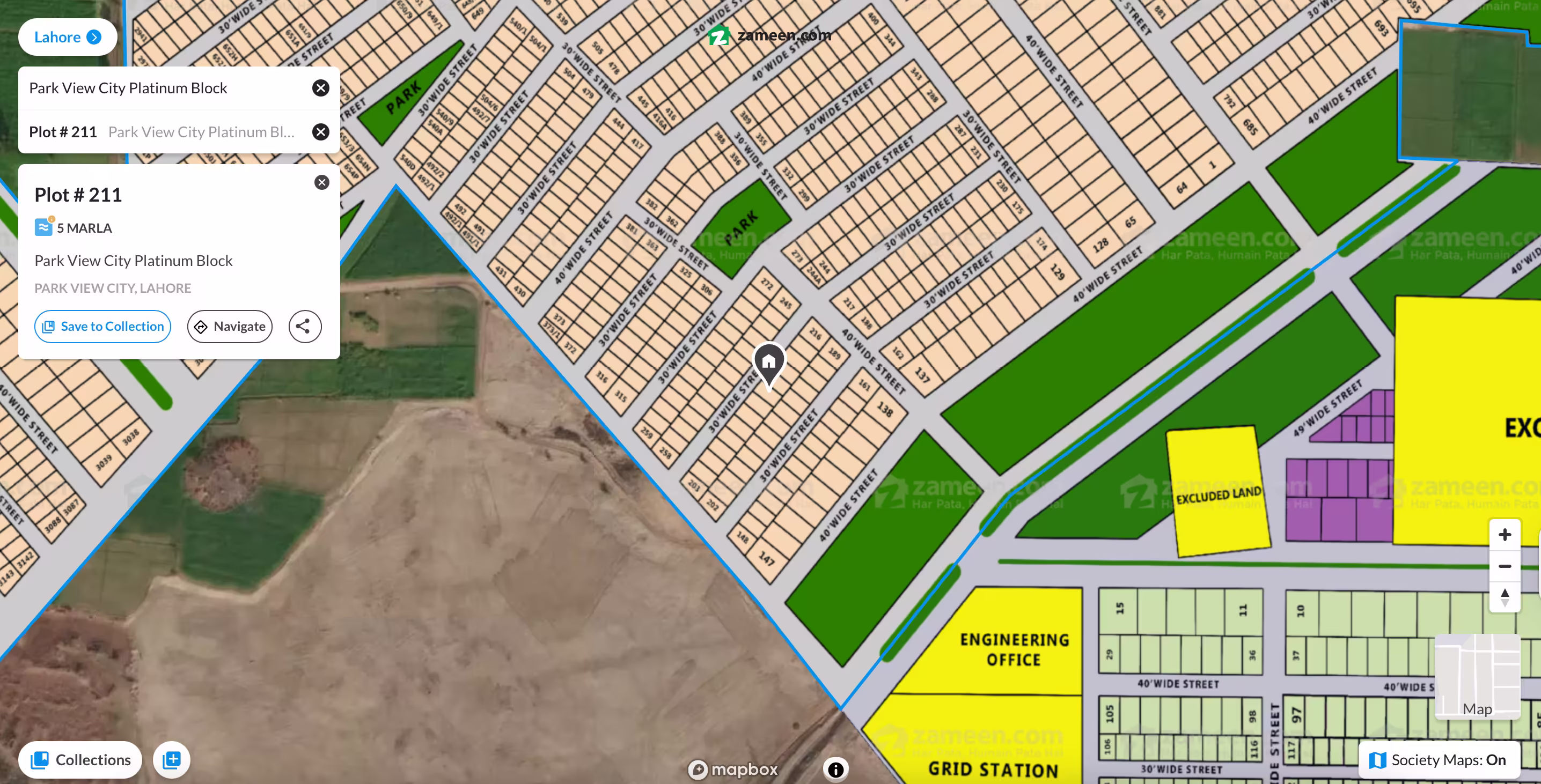
Plot 211 in Platinum Block, as shown by an online real estate website.
The above clues led us to this location in the Platinum Block — at the coordinates 31.45786686144117, 74.1806963695235 — on Google Maps. Then, by checking the houses in the second video and the plot area from the residential website from this region against the satellite imagery from Google Earth Pro, Soch Fact Check confirmed that this clip was indeed shot in the same block.
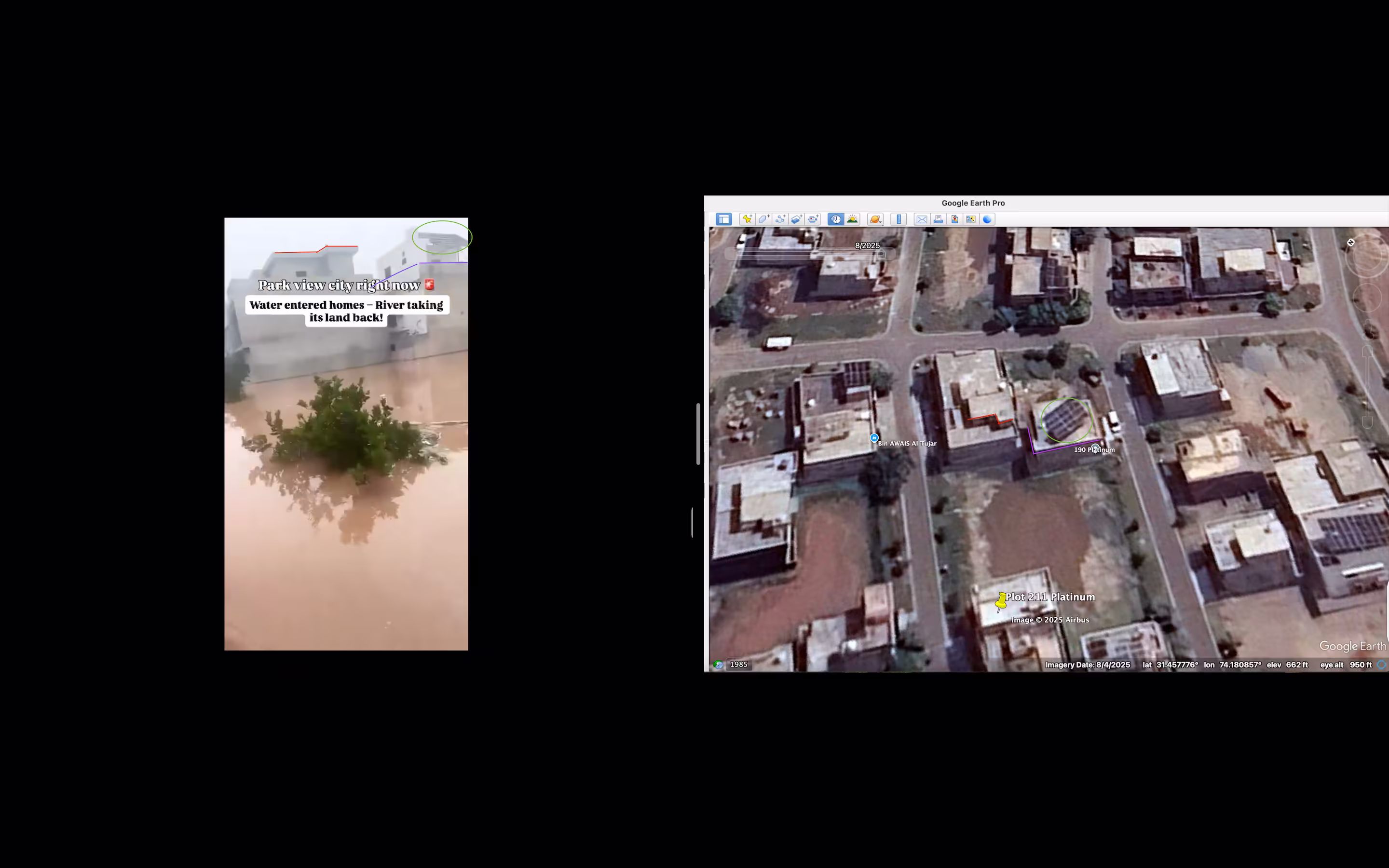
Houses visible on Google Earth Pro.
Following the same steps above (check “How we geolocated the video”), we verified another video from the Platinum Block showing rescue teams sailing through the submerged area, likely rescuing stranded residents. The coordinates for this clip are 31.45877952344545, 74.18263932152345.
💡
Crystal Block submerged
Geolocated videos show that floodwater also did not spare Crystal Block, a residential block adjacent to the Platinum Block, where some areas were partially or fully submerged.
In one instance, the person recording the footage from the rooftop explains how the area was submerged in waist-deep water and shows houses that were completely submerged.
The house where this video was shot lies approximately at the coordinates 31.450812234593393, 74.1850029819284 and the visual below shows features from the clip that match the satellite imagery.
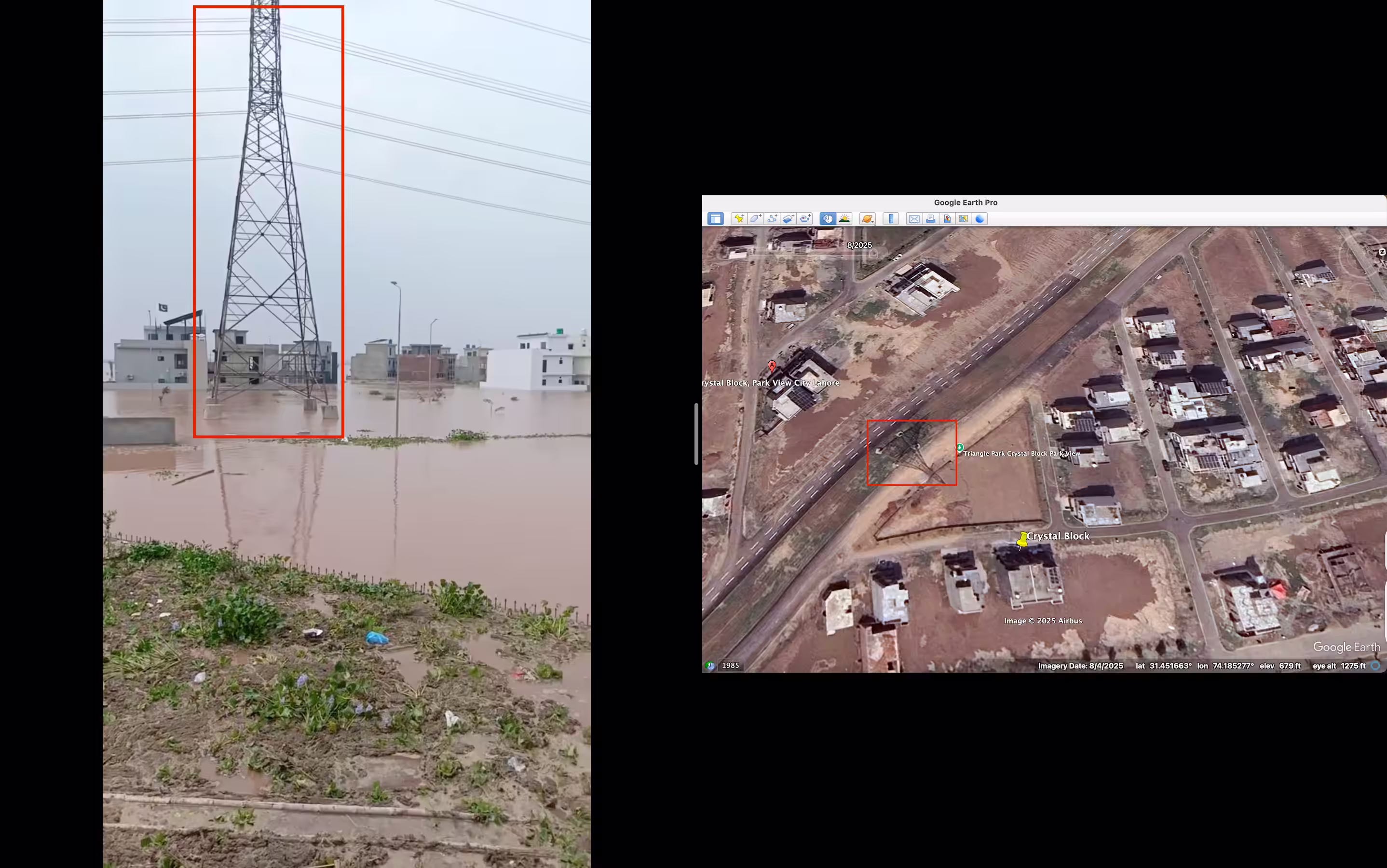
On the left is the area shown in the geolocated clip, which matches against satellite imagery on the right.
One verified video from Crystal Block depicts a resident showing the partially submerged area, found on the map at coordinates 31.453980080104614, 74.18461435236662. Another clip from this same area shows stagnant water.
💡
What we know so far from other locations
Soch Fact Check’s investigation has so far shed light on two residential blocks that were partially or fully submerged.
Another video that we geolocated features an individual showing a third residential area within Park View City, the Diamond Block, post-flooding, and a second clip of the same also depicts the aftermath of flooding.
Drone footage captured by our reporters further illustrates large chunks of Park View City completely submerged in floodwater.
According to Dawn, three other residential blocks, “Silver, Tulip (Extension), Overseas (Extension)”, were also flooded, which are in addition to the three that Soch Fact Check verified.
Therefore, the claim that Park View City was safe from flooding in the river Ravi is entirely false.
💡
Satellite imagery analysis
An aerial view of the residential area through Copernicus Browser, an online tool for viewing satellite images, shows that Park View City was flooded.
A zoomed-out view from 29 August, although clouded, depicted the area covered in sediment-laden floodwater, which appeared brown in True Colour optimised imagery, confirmed Thomas Bordeaux, a volunteer researcher with Bellingcat’s Global Authentication Project, who reviewed our findings.
According to the description of the True Colour filter by Copernicus Browser, “This optimised True color script uses the visible light bands red, green and blue in the corresponding red, green and blue color channels, resulting in a product with natural colours that represents the Earth as humans would naturally see it.”
Copernicus Browser showing Park View City covered in sediment-laden water.
Furthermore, when the same area is viewed using the False Colour bands, it appears covered in dark blue, which indicates flooding.
A false colour image is used for visualising features that are not clearly visible or are invisible to the human eye. False colour urban “composite is used to visualise urbanised areas more clearly… Flooded areas are very dark blue and almost black. The composite is useful for detecting wildfires and calderas of volcanoes, as they are displayed in shades of red and yellow”, according to the description of the feature provided by Copernicus Browser.
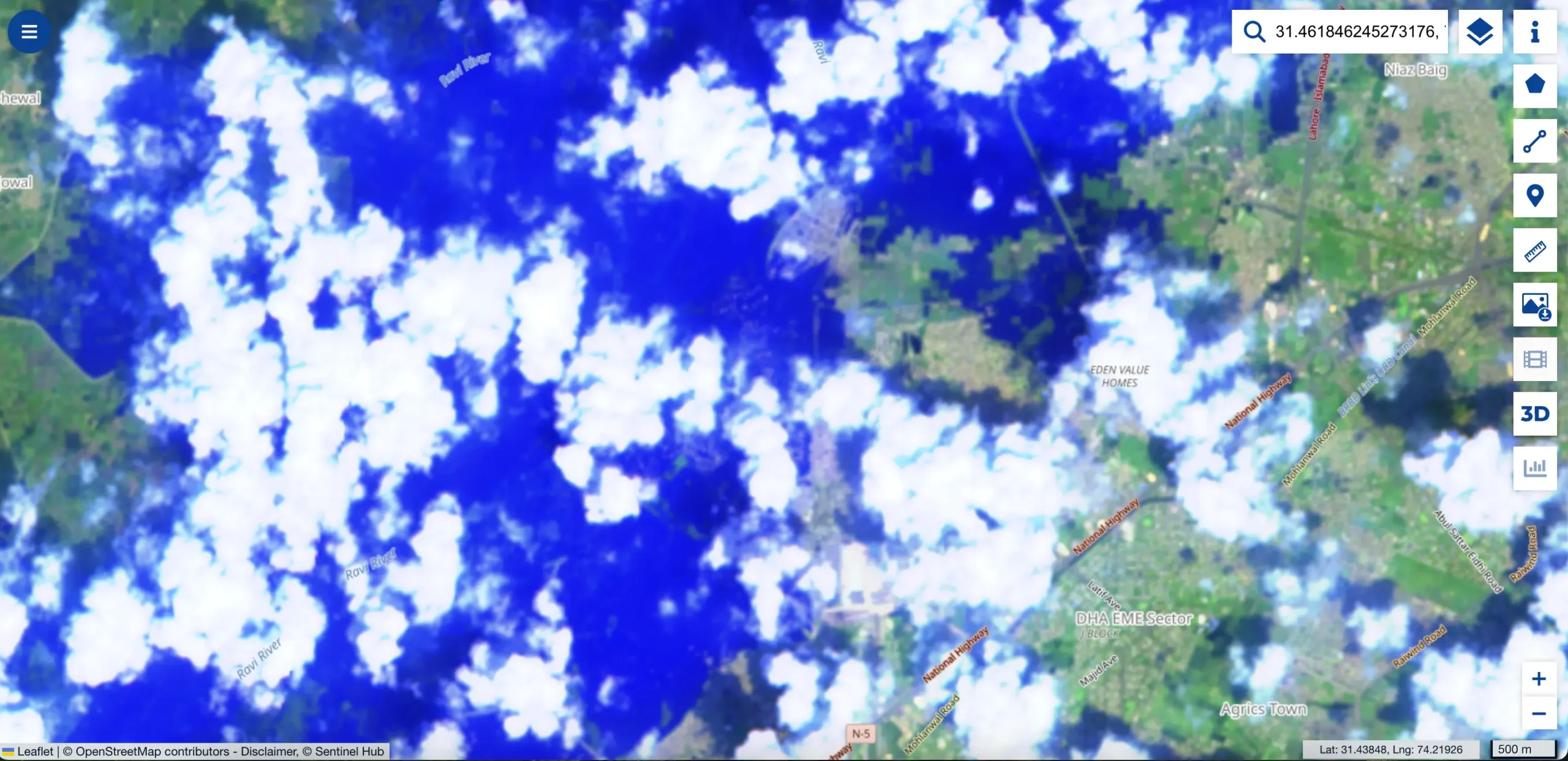
Copernicus Browser’s visualisation from 29 August of Park View City.
On the other hand, imagery from 22 August that predates the flooding shows a narrow river path and no flooding, as shown below:
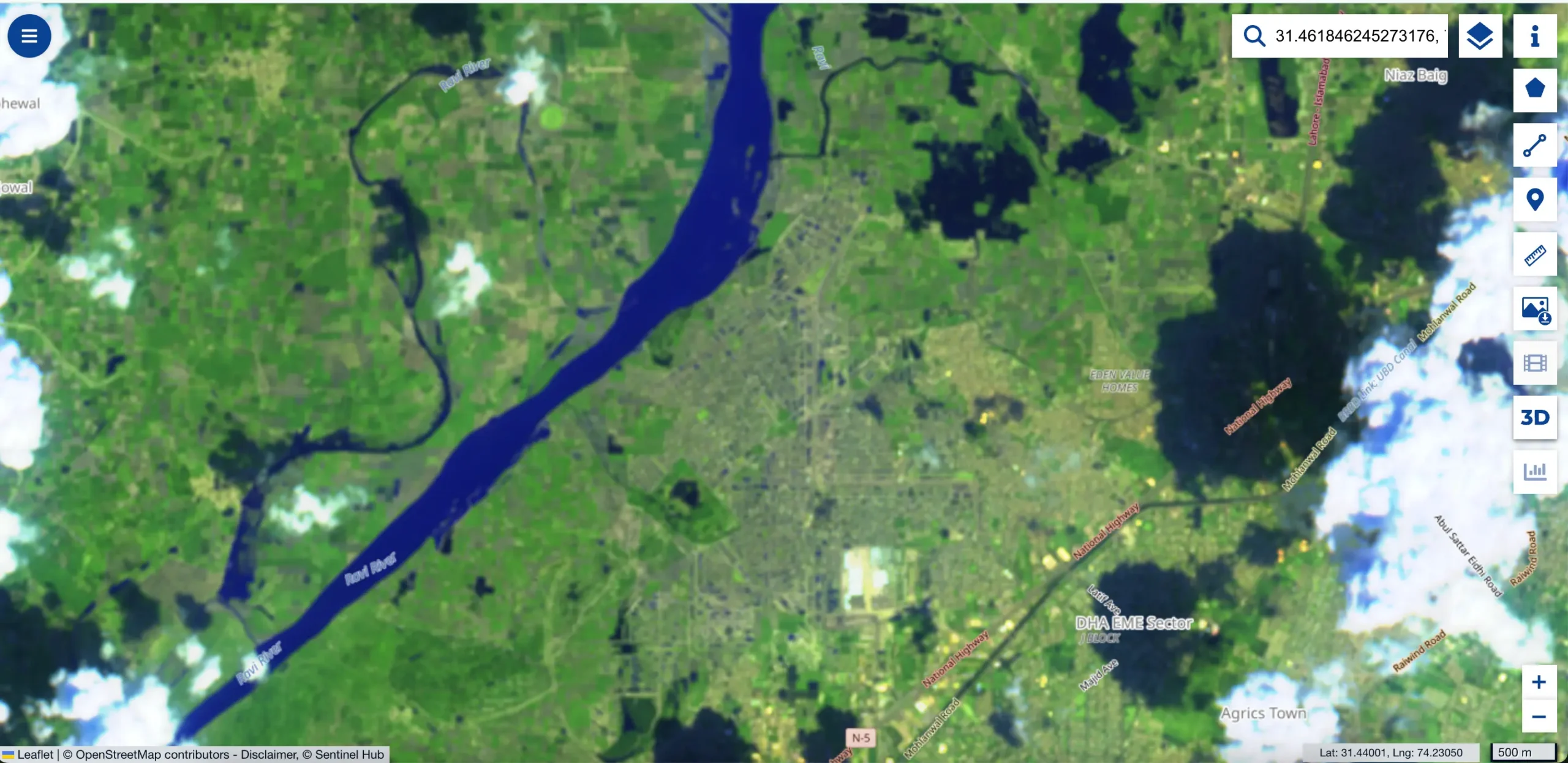
Copernicus’s visualisation from 22 August of Park View City, which shows a narrow river path.
Contrary to Aleem Khan’s claim, Soch Fact Check’s investigation of visuals emerging from Park View Society and Soch Videos’ on-ground reporting confirm that the housing society did get flooded to a point where the safety of its residents was at risk.
💡
Virality
Aleem Khan’s statement, which was posted on Instagram, has been viewed 135,000 times so far. Khan’s statement also appeared on Instagram here and here. It was also posted on Facebook, TikTok and YouTube.
His statement also appeared on X here, here, here.
His second statement, issued on 30 August 2025 and posted on both YouTube and Instagram, garnered over 27,000 and 1 million views, respectively.
💡
Conclusion: An investigation carried out by Soch Fact Check, based on publicly available information, open-source techniques to verify visuals circulating on social media, and on-ground reporting by Soch Videos correspondents, concludes that MNA Aleem Khan’s claim is incorrect. Multiple and large sections of the housing society were completely submerged with floodwater, which entered homes and stagnated the streets, forcing many to leave.
💡
To appeal against our fact-check, please send an email to appeals@sochfactcheck.com